Map view
The user interface includes the following main sections: the toolbar at the top, the map view, the map toolbar in the top left corner, the coordinate section at the bottom and the help section in the top right corner.
Note! If the border of the user interface is of an easily distinguishable bright colour, you are most likely using an environment that is not the production environment. Contact your system administrator if necessary.
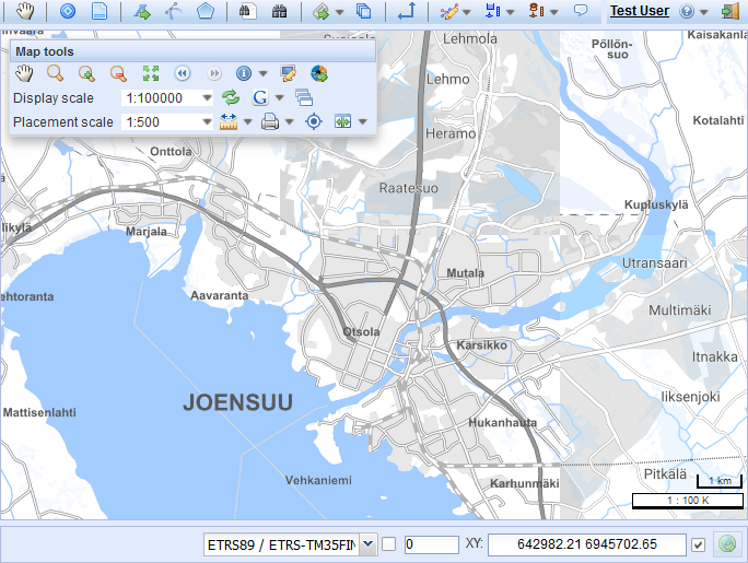
KeyWork tools and toolbar
The toolbar is located at the top of the screen. The toolbar can be used to open forms that are used to create, view and modify objects. The toolbar contains the actual KeyWork tools and other tools that you can use, for example, to search for addresses or to create reports. The KeyWork tools include Task search, Task, Subregion, Maintenance history search and Reports.
Layers
You can select the background map and layers using the Layers  tool. Click Layers
  to view the list of objects. The available map layers always depend on the customer and what has been agreed concerning the available maps.
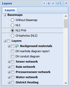
The default map is one of the available maps. You can also use other available maps to be used as the background map or you can select an empty map layer, in which case no background map is displayed. Only one map can be selected at a time to be used as the background map. The background map helps users understand where the network objects are located, and this map cannot be modified.
The network object layers available for selection are listed under object layers. You can select multiple layers to be shown at the same time. If an object layer is not selected, its objects are not displayed on the map and it is therefore not possible, for example, to pick them from the map for forms. For this reason, you should select at least those layers that have objects that you want to view or edit.
The checkbox to the left of a layer indicates whether the object has been selected. You can remove or add an object by clicking its checkbox. You do not need to refresh the map afterwards as your selections are applied automatically. If you want to activate all layers at once, select the checkbox for the highest layer (Layers). You can minimise or maximise the Layers tool by clicking the  button at the top of the form. To close the Layers form, click the
  button. In addition, the following buttons may be available: Reload, Save and Reset to defaults. Click the
  sign next to the background map and object layer lists to hide them.
Note! The speed of updating the map depends on the number of layers selected: the more layers are selected, the slower the map update. Therefore, you should only select the layers you need to view.
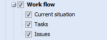
Layer selections
The layers related to work management can also be found in the layer menu. The layers to be displayed can be selected by user group in the KeyWork system’s admin interface.
- Current situation: The level includes open tasks entered into the system and tasks that were closed a maximum of 3 days ago. Tasks that are not yet completed are displayed using red symbols, tasks that have been ordered and on which mechanics are working are displayed in yellow, and recently completed tasks are displayed using green symbols.
- Faults: The layer displays all faults in the system
- Task: All tasks with location information entered into the system.
- Subregions: Displays the area objects created in the system.