KeyCom can use and display external WFS service data through the WFS interface.
WFS Service
- Url: address of the WFS service, such as. http://myserver.com/geoserver/service/wfs
- Version: WFS protocol version. The current recommendation is WFS v_1.1_.
- Capabilities xml: collection of WFS features in XML format. This must be compiled manually by combining the service address and a search string, for example, http://myserver.com/geoserver/service/wfs?SERVICE=WFS&VERSION=1.1.0&REQUEST=GetCapabilities.
- Options: Currently, an empty JSON collection: {}.
WFS Resource
- Name: a user-friendly name for the WFS meta resource.
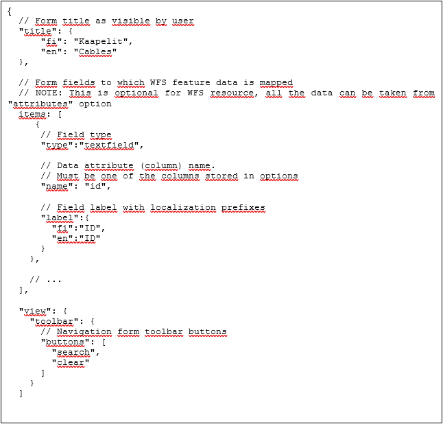
- Form: A description for the form fields (see the Defining the WFS resource form chapter).
- Options: options related to searching and displaying WFS data:
- id_attr: name of the id field.
- geometry_attr: name of the geometry attribute field.
- item_label_format: label format according to Python’s format specification.
- attributes: list of the fields to be retrieved. May include localisation.
- Service: The WFS service being used (see the WFS service chapter).
- Typename: field name offered by the selected WFS service.
- Description xml: a description of WFS features in XML format. This must be compiled manually by combining the service address and a search string, for example,http://myserver.com/geoserver/service/wfs?SERVICE=wfs&VERSION=1.1.0&REQUEST=describefeaturetype&TYPENAME=typename
Note that the TYPENAME parameter must be the same as the Typename defined above. - ID:
Defining the WFS resource form
The form must be defined in JSON format.
