The External Data tool allows you to browse and inspect external datasets that have been imported into the system. These datasets may include information from sources such as WFS services, external map layers, or other supported data sources.
You can review the contents of imported datasets, search for objects, and highlight them on the map.
Note!
The tool is intended for viewing and analyzing imported data and does not support importing new datasets.
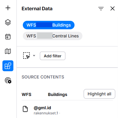
Filtering External Data
- Click Add filter.
- From the window that opens, select the attribute you want to filter by, such as Owner, Type, or another available field:
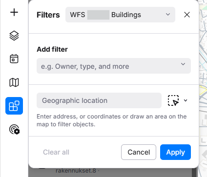
- Optionally, define a Geographic location by entering an address, coordinates, or by drawing an area directly on the map.
- Click Apply to display only the objects that match the selected criteria.
Highlighting objects on the map
To locate external data objects on the map:
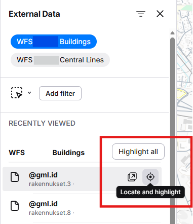
- Select the desired dataset.
- Locate and highlight
 the object you want to view.
- Click Highlight all to highlight all matching objects on the map.