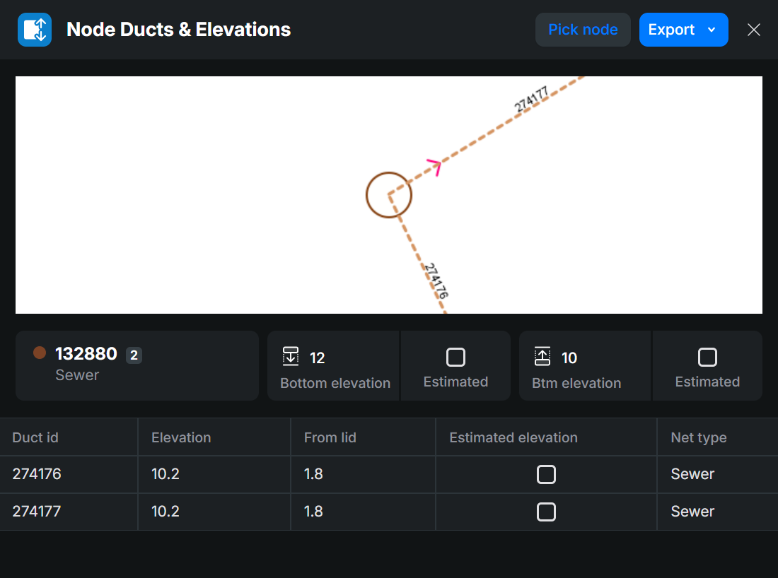
The Node ducts and elevations tool is used to view and update the elevation data for the selected node and the ducts connected to it. In the case of a sewer network node, you can create a printout called a Manhole survey card. The manhole survey card is used to display the data content and connections of the node and the ducts connected to it.
You can activate this tool from the Tools menu within the KeyAqua Nexus tools.
Picking node information
To retrieve node information to the form, use the Pick node tool and define an area on the map where the required object is located. If the area you define includes several nodes, a list of nodes will be displayed, and you can choose the node that you want by selecting it from the appearing Info window.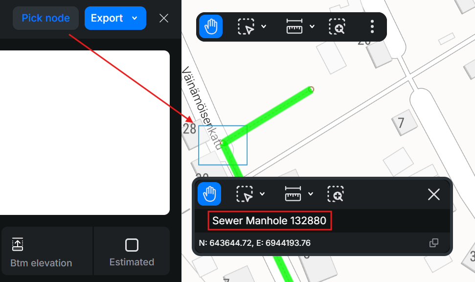
Viewing node information
The Node Ducts and Elevations form is used to view and update elevation data for the selected node and its connected ducts.
For sewer network nodes, you can generate a printout, which displays the node’s data and its duct connections. To download and print this manhole and condition-related data in PDF or XLSX format, click Export in the top-right corner of the form and select the preferred format.
Editing elevation data for connected objects
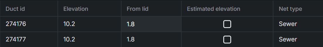
You can edit the elevation values of objects connected to a node directly in the object row. Select the desired column and update the values as needed. Press Enter to save the changes, or simply cancel to discard them. You can also check the Estimated elevation check box if the inserted value is an estimation.